Click on this menu for a direct access

TéSA Team
The core of TéSA is composed of its direction, its administrative assistant, its research engineers and partner researchers, present daily in TéSA’s premises.
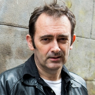
Serge Fabre
Research Engineer
Signal and Machine Learning
Personal page Read the details Publication list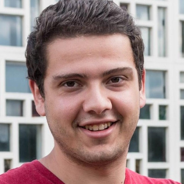
Samy Labsir
Associated Researcher
Statistical Signal Processing
Personal page Read the details Publication list
Bernard Lacaze
Associated Researcher
Stochastic Processes
Personal page Read the details Publication list
Patrice Michel
Associated Researcher
Signal Processing
Personal page Read the details Publication list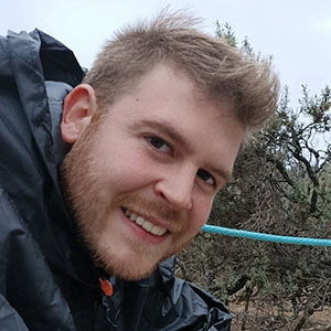
Lorenzo Ortega
Associated Researcher
Signal Processing
Personal page Read the details Publication list
Philippe Paimblanc
Research Engineer
Navigation and Positioning
Personal page Read the details Publication list
Raoul Prévost
Research Engineer
IT Manager
Digital Communications
Personal page Read the details Publication list
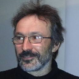
Jacques Sombrin
Associated Researcher
Satellite Systems
Personal page Read the details Publication list
Board of Directors
The board of directors of TéSA is composed of representatives of the different partner members, including the TéSA director. The co-Presidents of the TéSA Scientific Committee are invited at each meeting.
Meetings are held every two months.
See the members
President:
- Thierry Floriant (CNES)
Treasurer:
- Elias Bitar (Collins Aerospace)
Secretary:
- Xavier Olive (TAS)
Members:
- Corinne Mailhes (Toulouse INP) ‒ Director
Scientific Committee:
- Laurent Ferro-Famil (ISAE-SUPAERO)
- Riadh Dhaou (Toulouse INP)
Scientific Committee
The Scientific Committee gathers the scientific representatives from the academic associate members and partner members of TéSA, as well as representatives of its research engineers and PhD students.
It meets at the same frequency as the Board and manages the scientific life at TéSA: organizing seminars and Science Days, writing the two-yearly activity report, organizing calls for post-doctoral research and visiting researchers, etc.
See the members
Presidents:
- Laurent Ferro-Famil (ISAE-SUPAERO)
- Lorenzo Ortega (IPSA)
Academic and Industrial partner representatives:
- Gentian Jakllari (Toulouse INP)
- Eric Chaumette (ISAE-Supaéro)
- Antoine Blais (ENAC)
- Frédéric Guilloud (IMT Atlantique)
- Islam Boussaada (IPSA)
- Clément Dudal (CNES)
- Cédric Baudoin (TAS)
- Valérian Racaud (Collins Aerospace)
Academic liaison:
- Julien Lesouple (ENAC)
PhD student representatives:
- Robin Duprat (TéSA)
- Nicolas Gresset-Bourgeois (TéSA)
Research Engineer representative:
- Philippe Paimblanc (TéSA)
Invited experts:
- Digital communications: Tarik Benaddi (TAS) and Karine Zidane (TAS)
- Navigation : Lorenzo Ortega (IPSA), Samy Labsir (IPSA) and Sébastien Trilles (TAS)
- Networking: Emmanuel Lochin (ISAE), Riadh Dhaou (Toulouse INP) and André-Luc Beylot (Toulouse INP)
- Signal and image processing: François Vincent (ISAE)
- Satellite systems: Jacques Sombrin (TéSA)
- Satellite image processing: Gwendoline Blanchet (CNES), Vincent Martin (CNES)
- Radar image processing: Laurent Ferro-Famil (ISAE)
Invited:
- Corinne Mailhes (Director of TéSA)
- Thierry Floriant (President of TéSA)
Scientific Development
The Scientific Development Team has been created to take contacts with potential new partners who may be interested in working with TéSA.
The team is composed of people well-involved in TéSA, able to present the organization and the expertise of TéSA, in close relation with the Scientific Committee and the Direction.
See the members
- Clémence Pierangelo (President of TéSA)
- Corinne Mailhes (Director of TéSA)
- Jacques Sombrin (TéSA)
- Thierry Robert (CNES)
- Mathieur Gineste (TAS)
- Elias Bitar (Collins Aerospace)
- Xavier Barichard (XB coaching, http://www.xbcoaching.fr)
- Eric Luvisutto (SAT Conseil, https://satconseil.eu)
Academic Team
The association functions as a research laboratory, managed by a Scientific Committee and a Board of Directors (see above) and welcomes research engineers (see TéSA Team) as well as teachers/researchers from the academic associate members of TéSA, who can come and spend part of their research time in TéSA.
PhD Students
As a Resarch Lab, one of the TéSA priorities is to welcome PhD students.
Find below currently on-going PhD studies, as well as defended ones with their summary, full manuscript in PDF format and defense presentation (except for confidential PhDs).
Since most of the PhDs are written in French, the French title has been kept.
Current PhD Students:
Alexandre Laurent
Étude de la géométrie Riemannienne pour l'atténuation des interferences
Funding ENAC
Start in February 2026
Personal pageClément Lacire
Registration of satellite images by spatial contextualisation
Funding CNES - CS GROUP
Start in November 2025
Personal pageSamuele Alteri
Bias-bounded estimation of phase ambiguity for precise swarm positioning
Funding CNES - IPSA
Start in October 2025
Personal pageNicolas Gresset-Bourgeois
Protocols and RL Optimization for Nanosatellite Swarm Networks
Funding CNES - VIVERIS
Start in October 2025
Personal pageAyoub Hamza
Quantitative forest loss monitoring using the BIOMASS mission
Funding CNES - CESBIO
Start in October 2025
Personal pageKarima Ghamnia
Machine Learning for instrument parameter estimation
Funding CNES - TSN
Start in September 2025
Personal pageYassine Ariouich
Orchestration du Space Edge Computing dans les constellations satellitaires
Funding TAS - TéSA
Start in March 2025
Personal pageAlexandre Berezin
Identification modale pour aubes de turboréacteur
Funding CIFRE - SAFRAN Engines
Start in February 2025
Personal pageRobin Duprat
Design and Processing of GNSS Meta-Signals for Precise Positioning
Funding CNES - TAS
Start in November 2024
Personal pageAlexandre Brochard
Detection and Mitigation of Interferences for Satellite Systems
Funding FONISEN
Start in November 2024
Personal pageYoussef Minyari
Intérêt des formes d’ondes MIMO pour les liens FSO feeder pour les SatCom
Funding TAS - IMT Atlantique
Start in November 2024
Personal pageJulien Juaneda
QUIC-PEP for performing VPN over multi-system
Funding CNES - TAS
Start in October 2024
Personal pageYounes Boutiyarzist
Méthodes de fusion de données appliquées avec systèmes de surveillance et de navigation pour hélicoptères
Funding CIFRE - COLLINS Aerospace
Start in December 2023
Personal pageNina Haag
Model based GNSS - Robustness testing using fuzzing techniques
Funding CIFRE - COLLINS Aerospace
Start in December 2023
Personal pageMaurine Bouzeid
Registration and fusion of 3D point clouds
Funding CNES - TSN
Start in November 2023
Personal pageGeoffroy Heurtier
Améliorer la gestion de l’eau : développement d’une approche Machine Learning pour la production de données bathymétriques à partir de données spatiales
Funding CIFRE - CGI
Start in November 2023
Personal pageEstebán Morales Aguirre
Generation of precise and robust observables by GNSS/IMU hybridization
Funding CNES - ISAE
Start in October 2023
Personal pageLéa Dubreil
AI-based hybrid state estimation of non-stationary covariance matrices for GNSS navigation filters
Funding TAS - IPSA
Start in October 2023
Personal pageLinda Kanaan
Machine learning for robust satellite AIS receivers in dense maritime traffic areas - RobAIS
Funding KINEIS - Région Bretagne
Start in February 2023
Personal pageSee the past PhD Students
Paul Grislain
Apport de l'IA pour la caractérisation réseau et la gestion de la ressource SATCOM
Funding TAS - ENAC
PhD Defence in March 2026
Personal page Download the presentation Download the thesis Read the abstractJoan Miguel Bernabeu Frias
Utilisation des mesures de phase pour positionnement précis dans un essaim de satellites
Funding CNES - IPSA
PhD Defence in February 2026
Personal page Download the presentation Download the thesis Read the abstractValérian Mangé
FUSion et Corrélation de données Hétérogènes par l'Intelligence Artificielle
Funding CIFRE Nexeya
PhD Defence in December 2025
Personal page Download the presentation Download the thesis Read the abstractJihanne El Haouari
Calibration de Spectromètre par Résolution de Problèmes Inverses Parcimonieux pour le Sondage Atmosphérique
Funding CNES - TAS
PhD Defence in November 2025
Personal page Download the presentation Download the thesis Read the abstractMarta Bottani
Forest loss monitoring using multi-frequency radar and optical data
Funding CNES - ISAE
PhD Defence in November 2025
Personal page Download the presentation Download the thesis Read the abstractGastón De Boni Rovella
Machine learning-based Solutions for Channel Decoding in M2M-type Communications
Funding CNES - TAS
PhD Defence in December 2024
Personal page Download the presentation Download the thesis Read the abstractHamish Scott Mc Phee
Autonomous and Robust Time Scale Algorithm for a Swarm of Nanosatellites
Funding TéSA - CNES
PhD Defence in November 2024
Personal page Download the presentation Download the thesis Read the abstractEvelyne Akopyan
Fiabilité de l’Architecture Réseau des Systèmes Distribués sur Essaims de Nanosatellites
Funding TéSA - CNES
PhD Defence in October 2024
Personal page Download the presentation Download the thesis Read the abstractVictor Perrier
LEO/GEO congestion control mechanism based on the contribution of artificial intelligence.
Funding CNES - ISAE Supaéro
PhD Defence in March 2023
Personal page Download the presentation Download the thesis Read the abstractAnouar Jerbi
Non-Coherent Detection of Continuous Phase Modulation for Low Earth Orbit Satellite IoT Communications Affected by Doppler Shift
Funding TAS - IMT Atlantique
PhD Defence in March 2023
Personal page Download the presentation Download the thesis Read the abstractCorentin Lubeigt
Signal Processing for GNSS Reflectometry
Funding CNES - ISAE Supaéro
PhD Defence in February 2023
Personal page Download the presentation Download the thesis Read the abstractThomas Verheyde
Precise Cooperative Positioning of Low-Cost Mobiles in an Urban Environment
Funding CNES - TAS
PhD Defence in February 2023
Personal page Download the presentation Download the thesis Read the abstractVinicius Alves de Oliveira
Apprentissage profond pour la compression embarquée d'images d'observation de la Terre.
Funding CNES - TAS
PhD Defence in October 2022
Personal page Download the presentation Download the thesis Read the abstractAmal Boubaker
Performances des Protocoles de Transport dans les Constellations de Satellites
Funding CNES - TAS
PhD Defence in May 2022
Personal page Download the presentation Download the thesis Read the abstractFrançois Lamothe
Le problème de flot insécable: application à la gestion des communications d'une constellation de satellites.
Funding CNES - TAS
PhD Defence in November 2021
Personal page Download the presentation Download the thesis Read the abstractAdrien Thibaud
Répartition de flux dans les réseaux de contenu, application à un contexte satellite.
Funding TéSA - TAS
PhD Defence in September 2021
Personal page Download the presentation Download the thesis Read the abstractQuentin Demoulin
Systèmes et Algorithmes de Traitement d'Images pour l'Estimation de Déformées de Structures d'Avion en Vol
Funding AIRBUS
PhD Defence in April 2021
Personal page Download the presentation Download the thesis Read the abstractAnne-Marie Tobie
Hybridation GNSS/5G pour la navigation en milieu urbain
Funding CNES - TAS
PhD Defence in February 2021
Personal page Download the presentation Download the thesis Read the abstractAlexandre Tran N'Guyen Hoang
Routeur embarqué pour les communications critiques aéronautiques en environnement multi liens
Funding RCF
PhD Defence in January 2021
Personal page Download the presentation Download the thesis Read the abstractBarbara Pilastre
Estimation Parcimonieuse et Apprentissage de Dictionnaires pour la Détection d'Anomalies Multivariées dans des Données Mixtes de Télémesure Satellite
Funding CNES - AIRBUS DS
PhD Defence in November 2020
Personal page Download the presentation Download the thesis Read the abstractSelma Zamoum
Méthodes d'accès aléatoire pour les communications par satellite
Funding CNES - TAS
PhD Defence in November 2019
Personal page Download the presentation Download the thesis Read the abstractLorenzo Ortega Espluga
Signal optimization for Galileo evolution
Funding CNES - TAS
PhD Defence in November 2019
Personal page Download the presentation Download the thesis Read the abstractSimone Urbano
Detection and Diagnostic of Freeplay Induced Limit Cycle Oscillation in the Flight Control System of a Civil Aircraft
Funding AIRBUS
PhD Defence in April 2019
Personal page Download the presentation Download the thesis Read the abstractJulien Lesouple
Estimation Parcimonieuse de Biais Multitrajets pour les Systèmes GNSS
Funding CNES - M3 SYSTEMS
PhD Defence in March 2019
Personal page Download the presentation Download the thesis Read the abstractSylvain Cluzel
Système M2M/IoT par satellite pour l'hybridation d'un réseau NB-IoT via une constellation LEO
Funding CNES - TAS
PhD Defence in March 2019
Personal page Download the presentation Download the thesis Read the abstractRomain Chayot
Synchronisation, détection et égalisation de modulation à phase continue dans des canaux sélectifs en temps et en fréquence
Funding CNES - TAS
PhD Defence in January 2019
Personal page Download the presentation Download the thesis Read the abstractBastien Tauran
On the interaction between transport protocols and link-layer reliability schemes for satellite mobile services
Funding CNES - TAS
PhD Defence in December 2018
Personal page Download the presentation Download the thesis Read the abstractCharles-Ugo Piat-Durozoi
Nouvelle forme d’onde et récepteur avancé pour la télémesure des futurs lanceurs
Funding CNES - IRIT
PhD Defence in November 2018
Personal page Download the presentation Download the thesis Read the abstractNabil Kbayer
Advanced Signal Processing Methods for GNSS Positioning with NLOS/Multipath Signals
Funding CNES
PhD Defence in October 2018
Personal page Download the presentation Download the thesis Read the abstractYoann Couble
Optimisation de la gestion des ressources voie retour
Funding CNES - TAS
PhD Defence in September 2018
Personal page Download the presentation Download the thesis Read the abstractÉlie Bouttier
Livraison de contenus sur un réseau hybride satellite / terrestre
Funding CNES - TAS
PhD Defence in July 2018
Personal page Download the presentation Download the thesis Read the abstractLucien Canuet
Reliability of Satellite-to-Ground Optical Communication
Funding CNES - TAS - AIRBUS DS
PhD Defence in April 2018
Personal page Download the presentation Download the thesis Read the abstractFábio Manzoni Vieira
Fusion of AIS and Radar Data for Maritime Surveillance
Funding TAS
PhD Defence in November 2017
Personal page Download the presentation Download the thesis Read the abstractÉric Asselin
Systèmes de détection et de prévention d'intrusion adaptés au monde aéronautique embarqué
Funding RCF
PhD Defence in June 2017
Personal page Download the presentation Download the thesis Read the abstractKarine Zidane
Improving Synchronous Random Access Schemes for Satellite Communications
Funding CNES - TAS
PhD Defence in November 2016
Personal page Download the presentation Download the thesis Read the abstractRami Ali Ahmad
Mécanismes de fiabilité bi-directionnels “couches basses” pour les communications par satellite
Funding CNES - TAS
PhD Defence in June 2016
Personal page Download the presentation Download the thesis Read the abstractJean-Adrien Vernhes
Echantillonnage Non Uniforme : Application aux filtrages et aux conversions CAN/CNA (Convertisseurs Analogique-Numérique et Numérique-Analogique) dans les télécommunications par satellite
Funding CNES - TAS
PhD Defence in January 2016
Personal page Download the presentation Download the thesis Read the abstractTarik Benaddi
Sparse Graph-Based Coding Schemes for Continuous Phase Modulations
Funding CNES - TAS
PhD Defence in December 2015
Personal page Download the presentation Download the thesis Read the abstractSi Quoc Viet Trang
FLOWER, an Innovative Fuzzy Lower-than-Best-Effort Transport Protocol
Funding CNES - TAS
PhD Defence in December 2015
Personal page Download the presentation Download the thesis Read the abstractJorge Prendes
New statistical modeling of multi-sensor images with application to change detection
Funding CNES - SONDRA/SUPELEC
PhD Defence in October 2015
Personal page Download the presentation Download the thesis Read the abstractJean-Baptiste Dupé
Ordonnancement et gestion des ressources pour un système de Télécommunications haut débit : Optimisation de la bande passante satellite
Funding CNES - TAS
PhD Defence in October 2015
Personal page Download the presentation Download the thesis Read the abstractNil Garcia
Méthodes d'optimisation pour la localisation active et passive des cibles
Funding TéSA
PhD Defence in April 2015
Personal page Download the presentation Download the thesis Read the abstractGuillaume Artero Gallardo
Qualité de service dans des environnements réseaux mobiles, contraints et hétérogènes
Funding RCF
PhD Defence in March 2015
Personal page Download the presentation Download the thesis Read the abstractMarion Roudier
Analysis and Improvement of GNSS Navigation Message Demodulation Performance in Urban Environments
Funding CNES - TAS
PhD Defence in January 2015
Personal page Download the presentation Download the thesis Read the abstractArnaud Dion
Récepteur de navigation reconfigurable pour applications spatiales
Funding TAS - ISAE Supaéro
PhD Defence in September 2014
Personal page Download the presentation Download the thesis Read the abstractRenaud Sallantin
Optimisation de bout-en-bout du démarrage des connexions TCP
Funding CNES - TAS
PhD Defence in September 2014
Personal page Download the presentation Download the thesis Read the abstractPatrice Raveneau
Satellites d'observation et réseaux de capteurs autonomes au service de l'environnement
Funding TéSA
PhD Defence in June 2014
Personal page Download the presentation Download the thesis Read the abstractPaulo Esteves
High-Sensitivity Adaptive GNSS Acquisition Schemes
Funding CNES
PhD Defence in May 2014
Personal page Download the presentation Download the thesis Read the abstractVictor Bissoli Nicolau
Performances de détection et de localisation des terminaux SAR dans le contexte de transition MEOSAR
Funding CNES - TAS
PhD Defence in January 2014
Personal page Download the presentation Download the thesis Read the abstractSébastien Roche
Méthodes de poursuite de phase pour signaux GNSS multifréquence en environnement dégradé
Funding CNES - TAS
PhD Defence in December 2013
Personal page Download the presentation Download the thesis Read the abstractAude Bourdeau
Approches avancées de navigation par signaux GNSS en environnement urbain utilisant un modèle 3D
Funding TAS - DGA
PhD Defence in December 2013
Personal page Download the presentation Download the thesis Read the abstractZhongxun Liu
Modélisation des signatures radar des tourbillons de sillage par temps de pluie
Funding ONERA
PhD Defence in May 2013
Personal page Download the presentation Download the thesis Read the abstractFlorian Cazes
Méthodes de traitement innovantes pour les systèmes de commandes de vol
Funding AIRBUS
PhD Defence in March 2013
Personal page Download the presentation Download the thesis Read the abstractSébastien Carcanague
Algorithmes de réception GNSS multifréquence pour positionnement précis
Funding M3 SYSTEMS
PhD Defence in February 2013
Personal page Download the presentation Download the thesis Read the abstractJean-Philippe Goy
Détection d'obstacles et de cibles de collision par un radar FMCW aéroporté
Funding RCF
PhD Defence in December 2012
Personal page Download the presentation Download the thesis Read the abstractRémi Diana
Le routage dans les réseaux DTN : du cas pratique des réseaux satellitaires quasi-déterministes à la modélisation théorique
Funding CNES - TAS
PhD Defence in December 2012
Personal page Download the presentation Download the thesis Read the abstractHugo Meric
Codage par superposition pour les communications par satellite
Funding CNES - TAS
PhD Defence in November 2012
Personal page Download the presentation Download the thesis Read the abstractDamien Serant
Algorithmes avances de traitement du signal pour réception des signaux GNSS et OFDM
Funding CNES - TAS
PhD Defence in November 2012
Personal page Download the presentation Download the thesis Read the abstractRaoul Prévost
Décodage et localisation AIS par satellite
Funding CNES - DGA
PhD Defence in October 2012
Personal page Download the presentation Download the thesis Read the abstractClément Dudal
Etude de la forme d'onde et d'un récepteur pour des systèmes de diffusion par satellite haute capacité
Funding TéSA - TAS
PhD Defence in October 2012
Personal page Download the presentation Download the thesis Read the abstractCarlos Daniel Salós Andrés
Contrôle d’intégrité appliqué à la réception des signaux GNSS en environnement urbain
Funding CNES - TAS
PhD Defence in July 2012
Personal page Download the presentation Download the thesis Read the abstractChao Lin
Analyse des ondes P et T des signaux ECG à l'aide de méthodes Bayésiennes
Funding TéSA
PhD Defence in July 2012
Personal page Download the presentation Download the thesis Read the abstractThomas Ferrandiz
Maîtrise des latences de communication dans les réseaux bord SpaceWire
Funding CNES - TAS
PhD Defence in March 2012
Personal page Download the presentation Download the thesis Read the abstractFabrice Hobaya
Convergence vers IP des systèmes de télécommunication par satellite
Funding CNES - TAS
PhD Defence in September 2011
Personal page Download the presentation Download the thesis Read the abstractDavid Pradas
Conception et méthodologie cross-layer pour les réseaux satellite à haut débit
Funding CNES
PhD Defence in September 2011
Personal page Download the presentation Download the thesis Read the abstractCarlos Giraldo Rodriguez
Manet Routing Assisted by Satellites
Funding TAS - Telecom Bretagne
PhD Defence in April 2011
Personal page Download the presentation Download the thesis Read the abstractFares Fares
Traitement des signaux ARGOS 4
Funding CNES - TAS
PhD Defence in March 2011
Personal page Download the presentation Download the thesis Read the abstractAmine Bouabdallah
Contributions à la fiabilisation du transport de la vidéo
Funding CNES - TAS
PhD Defence in December 2010
Personal page Download the presentation Download the thesis Read the abstractPaul Thevenon
Interface air pour systèmes de navigation en bande S : étude détaillée des signaux OFDM
Funding CNES - TAS
PhD Defence in November 2010
Personal page Download the presentation Download the thesis Read the abstractAxel Garcia Pena
Optimisation de la Performance de Démodulation des Messages de Navigation GPS et GALILEO
Funding CNES - TAS
PhD Defence in October 2010
Personal page Download the presentation Download the thesis Read the abstractChristophe Ouzeau
Degraded Modes Resulting From the Multi Constellation Use of GNSS
Funding DTI
PhD Defence in July 2010
Personal page Download the presentation Download the thesis Read the abstractJulien Montesinos
Traitement d'antenne SDMA pour système de télécommunications par satellite avec couverture dispersée
Funding TAS
PhD Defence in November 2009
Personal page Download the presentation Download the thesis Read the abstractMariana Spangeberg
Safe Navigation for Vehicles
Funding TAS
PhD Defence in June 2009
Personal page Download the presentation Download the thesis Read the abstractAnh Tai Ho
Application des techniques multiporteuses OFDM pour futurs systèmes de télécommunications par satellite
Funding CNES - TAS
PhD Defence in March 2009
Personal page Download the presentation Download the thesis Read the abstractBenjamin Chibout
Traitement des signaux boc pour la radionavigation
Funding CNES - TAS
PhD Defence in December 2008
Personal page Download the presentation Download the thesis Read the abstractXavier Delaunay
Compression d'images satellite par post-transformées dans le domaine ondelettes
Funding CNES
PhD Defence in November 2008
Personal page Download the presentation Download the thesis Read the abstractEmmanuel Dubois
Convergence dans les réseaux satellite
Funding TAS
PhD Defence in November 2008
Personal page Download the presentation Download the thesis Read the abstractAnchalee Puengnim
Classification de modulations linéaires et non-linéaires à l’aide de méthodes Bayésiennes
Funding CNES
PhD Defence in September 2008
Personal page Download the presentation Download the thesis Read the abstractLucile Canourgues
Algorithmes de Routage dans les Réseaux Mobile Ad hoc Tactique à Grande Echelle
Funding RCF
PhD Defence in May 2008
Personal page Download the presentation Download the thesis Read the abstractJuan Cantillo
Codage multi-couches pour systèmes de communication par satellites
Funding TAS
PhD Defence in May 2008
Personal page Download the presentation Download the thesis Read the abstractFerdinand Tra
Contrôle d’Admission des Connexions pour les Systèmes de Télécommunication par Satellite avec des Liaisons Physiques Adaptatives
Funding TAS
PhD Defence in January 2008
Personal page Download the presentation Download the thesis Read the abstractHanna El Natour
Techniques avancées de traitement du signal GPS pour les services LBS
Funding TAS
PhD Defence in July 2007
Personal page Download the presentation Download the thesis Read the abstractEmmanuel Christophe
Compression des Images Hyperspectrales et son Impact sur la Qualité des Données
Funding CNES - TAS
PhD Defence in October 2006
Personal page Download the presentation Download the thesis Read the abstractJean-Pierre Millerioux
Techniques de détection multi-utilisateurs pour les communications multifaisceaux par satellite
Funding CNES - TAS
PhD Defence in September 2006
Personal page Download the presentation Download the thesis Read the abstract
Postdocs
As a Research Lab, TéSA welcomes postdoctoral researchers (postdocs).
Find below the list of current and past postdocs.
Current Postdocs:
Angèle Hafaiedh
Optimisation du scheduler de gNB 5G pour les constellations de satellites en orbite basse
Funding CNES
Start in September 2025
Personal pageHamish Scott Mc Phee
Echelle de temps autonome robuste aux erreirs d'horloges pour les essaims de satellites
Funding TéSA - TAS
Start in February 2025
Personal pageSee the past Postdocs
Serigne-Daouda Pene
Development of new supervised methods based on Gaussian process on Lie groups. Application to image registration
Funding IPSA
End in 2026 (15 months)
Personal pageArthur Renaudeau
Démosaïquage d’images acquises par filtres matriciels multispectraux
Funding CNES
End in 2025 (10 months)
Personal pageKin Mimouni
Intégrité pour les récepteurs nouvelles générations
Funding TéSA - TAS
End in 2023 (18 months)
Personal pageLorenzo Ortega Espluga
GNSS robuste en environnement contraint
Funding TéSA - ISAE Supaéro
End in 2021 (18 months)
Personal pageJulien Lesouple
Détection séquentielles d’anomalies pour la télémesure satellite avec retour utilisateur
Funding TéSA - TAS
End in 2021 (18 months)
Personal pageRaoul Prévost
Hybridation GNSS - UWB
Funding TéSA - BPI France/Eurostars
End in 2015 (24 months)
Personal pageTuan Tran Thai
Analyse de l'intégration de codes à effacement pour l'architecture DTB spatiale
Funding CNES
End in 2014 (13 months)
Personal pageRomain Tajan
Nouvelles formes d'ondes pour des communications aéronautiques à forte efficacité spectrale
Funding CNES
End in 2014 (8 months)
Personal pageJames Mure-Dubois
Study of radar processing applied to the automotive active safety
Funding DGCIS
End in 2011 (24 months)
Personal pagePhilippe Paimblanc
Traitement du signal en sortie d'antenne sur équipement DF-430
Funding RCF
End in 2006 (12 months)
Personal pageADDRESS
7 boulevard de la Gare
31500 Toulouse
France

CONTACT

